Category Archives: Media

Exploring the big picture, the little picture and everything in-between with a multi-scale map

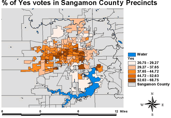
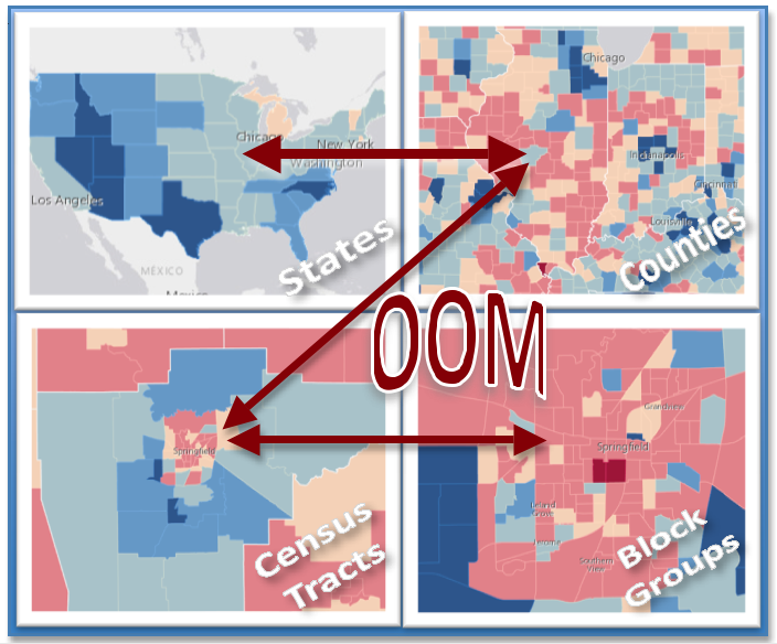
When viewing interactive, online maps, we’ve come to expect more details when zoomed in and fewer details when zoomed out. Streets, rivers, landmarks, buildings appear and disappear at different zoom levels. While most are aware that multi-scale maps are essential for navigation, their value for analyzing demographic trends from the world view all the way […]

Read More

Cube World Projection Puzzle – Fun & easy to make but a challenge to solve!

Steps to making a world cube puzzle: 1. Open up a new map in ArcMap (For a 60 Day ArcMap trial visit http://www.esri.com/software/arcgis/arcgis-for-desktopState-wide. Site licenses for K-12 are available for certain states. Illinois teachers may apply for an ArcMap license at https://illinoised.maps.arcgis.com/home/) 2. Choose a world basemap (I chose the National Geographic basemap) 3. Change […]

Read More